AI‑Driven Maps Track Arctic Permafrost Thaw via Disappearing Lakes
Scientists use satellite imagery and AI to track disappearing Arctic lakes, creating near‑real‑time maps of permafrost thaw that aid community planning.
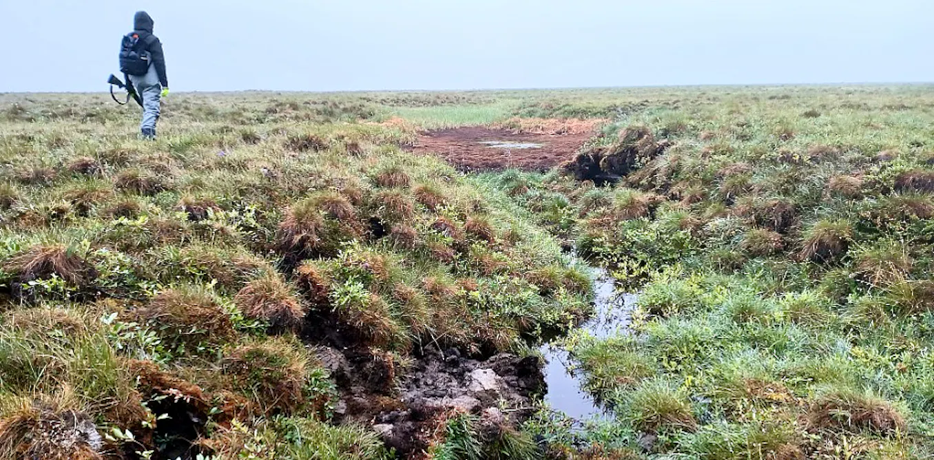
Scientists are using disappearing Arctic lakes and artificial intelligence to track permafrost thaw in near-real time, providing crucial data for communities facing ground instability risks. The team, led by hydrologists and data scientists through the Permafrost Discovery Gateway, has developed an interactive mapping tool to monitor over 4 million lakes and 70 million thermokarst ponds across the Arctic, including Alaska’s tundra regions.
Permafrost—ground that remains below freezing for at least two years—covers much of Alaska and other Arctic regions. When ice-rich permafrost thaws, the ground collapses, creating depressions that fill with water known as thermokarst ponds. These formations are visible in satellite imagery and serve as key indicators of permafrost degradation. In some cases, thawing permafrost triggers new drainage channels that can drain entire lakes in hours, leaving behind barren basins.
Historical aerial photos and satellite imagery dating back to the 1940s have helped researchers reconstruct past permafrost landscapes. Now, artificial intelligence enables rapid analysis of new images to detect changes such as the formation or disappearance of ponds and lakes. This technology allows scientists to monitor permafrost thaw across large Arctic regions more efficiently than ever before.
The Seward and Baldwin peninsulas in northwestern Alaska have experienced significant lake drainage over the past two decades. In 2018 alone, nearly 200 lakes lost more than a quarter of their area following an unusually warm winter. Even with a colder-than-average winter in 2025-26, the region continued to see lake drainage events, with around 30 lakes affected in June and July 2026. While not all lake changes are due to permafrost thaw—seasonal flooding and beaver activity can also alter lake formations—these patterns help scientists identify areas of active permafrost degradation.
The new near-real-time mapping tool provides communities with critical information to plan construction and infrastructure projects safely. By identifying areas underlain by ice-rich permafrost, the maps help planners avoid high-risk building sites. Previously, permafrost thaw data was often delayed by years, making it difficult for communities to respond quickly to changing conditions. Today’s AI-driven technology offers a real-time solution for monitoring and adaptation.
Researchers emphasize that while lake drainage events are a strong indicator of permafrost thaw, other factors such as seasonal water fluctuations and wildlife activity can also influence these changes. However, the combination of disappearing lakes and AI analysis provides a powerful method for tracking Arctic permafrost degradation and supporting community resilience.
#PermafrostThaw #ArcticResearch #AlaskaLakes #ClimateChange #AIClimateScience #ThermokarstPonds #PermafrostMapping #ArcticCommunities
Comments (0)
No comments yet — be the first to weigh in.
Related Coverage
 Science
DSM-6 to Integrate Biology in Mental Health Diagnosis for First Time
The DSM-6 will incorporate biological factors for the first time, marking a shift towards evidence-based psychiatry. Explore the challenges and advancements in neurobiology shaping the next edition.
 Science
Islanders asked to report sightings of rare eel
Islanders Urged to Report Sightings of Critically Endangered European Eel in Guernsey Guernsey’s Nature Commission is appealing to residents to report sightings...
 Science
The importance of teaching students what AI can’t do
The growing role of artificial intelligence in education raises concerns about over-reliance on AI tools and the potential erosion of critical thinking skills a...
 Science
More protein in your breakfast or snacks won’t give you more muscle without more work – a biologist separates the science from the marketing
The modern breakfast aisle looks dramatically different than it did a generation ago, with protein-enriched cereal, bread, chips, and even Pop-Tarts now crowdin...
Most Read

Canada's Solar Energy Growth: Provinces Chart Diverse Paths to 2035 Goals

Autumn Hill Sentenced to 50 Years in Prison for Anti-ICE Protest: A Case of Political Persecution?

Hull City Secure 1-0 Away Win at Coventry, Maintain Perfect Premier League Start
DSM-6 to Integrate Biology in Mental Health Diagnosis for First Time